

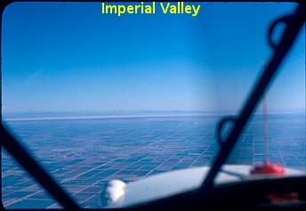
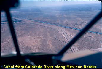


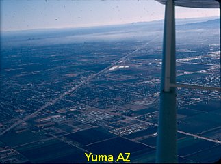
At the dawn of the new year, it was time to head east. I departed Lindberg Int’l, and flew along the Mexican border to Yuma, Arizona. This took me over the Imperial Valley, sand hills and a lot of saguaro cacti. I called Yuma Int’l on every published frequency and got no response. The sky was severely clear, and there was no traffic in the air or on the ground, so I went ahead and landed. I’d been in the air 2:10, and I needed gas. I was summoned to the phone to receive a reaming from the control tower as soon as I exited my plane, but when I explained all the frequencies I had tried, they relented and admitted that they had that radio turned off. After fueling I followed the Gila River for 2 hours up to Phoenix-Litchfield for another gas stop and to camp for the night.
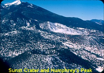
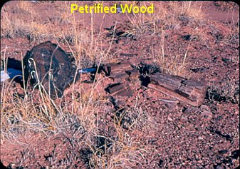
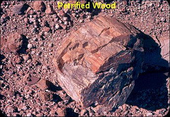
On the next day I skirted the west side of Phoenix, and followed the highway up to Flagstaff. I was indicating 95 mph, but below me on the highway, a muscle car was beating me on the straight stretches. I only got ahead of him by cutting the corners. I headed east out of Flagstaff. I regret passing so close to Meteor Crater without realizing it, and missing the opportunity to fly over it. However, when I got to Petrified Forest Nat’l Monument, I landed in a dry wash, and took in the petrified trees up close and personal.


I landed at Grants Pass, New Mexico, but there was no gas at the airport. So I hopped over to the nearby gas station, landed in the large, deserted gravel parking lot, and gassed up there. It was getting to be late afternoon, but Albuquerque wasn’t too much farther, so I pushed on. It got to be pitch black before I got there. Since I had no cockpit or instrument lighting, I had to judge my throttle setting by sound. I found my way to Coronado, the general aviation airport in Albuquerque. Upon landing I lost all forward visibility when the tail settled down. I’d get a glimpse of the runway lights, first out one side and then the other, as I swerved from one side of the runway to the other before coming to a stop. For the first time I knew real fear. This was reinforced the next day when I saw the ditches down both sides of the runway.
The purpose of this stop was to visit one of the sons of the family with whom I was boarding back in Logan. I spent the next day with him and his family, and I got a tour of Old Town Albuquerque. It was nice, but I needed to be back in class; remember, I’m still just a college freshman. So on January 4th I plotted an actual course for the first time for a bee line back to Logan. I left Coronado on a 296 degree heading until hitting Rio Puerco, then turning to 316 degrees to follow airway Victor 187 past the east end of Chaco Mesa.
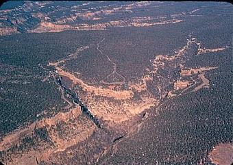
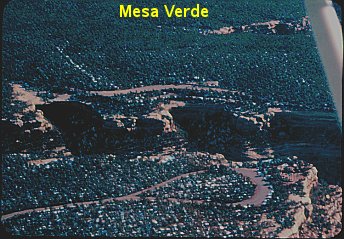
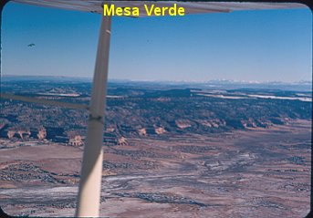
This course took me past Farmington, NM, and directly over Mesa Verde in the southwest corner of Colorado.


I landed at Dove Creek, CO (elev 6975′) after a long 2:55 haul, but evidently they didn’t have gas because I made a 25 minute dog leg to Monticello, Utah, where I recall conversation in the local cafe to the effect that the sheriff grew the best pot in the area.
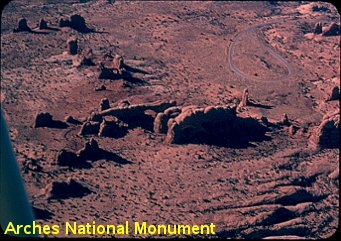


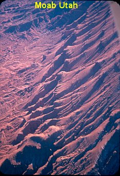
From Monticello I followed the highway up to Moab where I flew past The Arches National Monument and picked up a compass course of 303 degrees. Overflying Carbon County Airport at Price, I turned to 294 degrees towards Provo, Utah, but I ran into a snowstorm with only 1/4 mile visibility while flying through the pass in the Wasatch Plateau. By dropping down on the deck and following the highway, I managed to get through to the clear skies of the Salt Lake Valley. I stopped for gas at Provo after a 3:00 hour flight. It only took another hour and a half to get back to Logan.
I still have all the WAC charts from this era, and they are a thing of beauty. They have vivid colors and show every mine and mountain peak, every stream and dry wash. Nothing like you get today. Even the names are exotic: Sangre de Cristo Mts, Bryce Canyon, Estacado Plain and Gila River. I’d love to go back some day.
