
This is the story of a flight down to Alabama on November 16th, 2001.
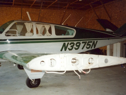
Phil Bussiere, my hanger mate wanted a gas fireplace insert for his house, but didn’t want to pay the shipping from Birmingham, which was the only place that had a model big enough for his fireplace. And it’s only 1000 miles away, so, hell, why not fly down to get it. We left in his 1947 Bonanza at 7 am on a Thursday morning and after cruising at 8500′, made our first stop for lunch at Reading, PA. From there it was straight down the Shennandoah Valley at 6500′ to Dublin or Pulaski (we’re not sure what the town name was), in VA for gas. Next we stopped at Johnson City, TN to buy IFR charts, because it was starting to rain. They didn’t have any, so we went further down the line to Knoxville, where we faked the ILS approach using GPS for navigation, since we didn’t know the ILS frequency. It was now 6 p.m. and the pilot supply store was closed, but we borrowed IFR charts from a corporate jet pilot who was waiting for a pizza and photocopied them. Then it was another couple of hours of flying in rain to Birmingham. We missed supper, but the airport van took us into town to a motel for the night. We got settled in around 10 p.m.
Next morning we had a good breakfast at the Omelet Shoppe next to the motel, then borrowed a car to go pick up the fireplace stuff. It was after 10 am by then time we had the gas burner and 3 boxes of ceramic logs loaded in the plane and were ready to go. It was overcast, but the clouds broke up soon after we climbed out to 11,500′, and we had a nice view of Lookout Mountain at Chattanooga, and the Great Smokies sticking up through the clouds to the east. We flew a slightly more westerly route over West Virginia, which is an endless series of ridges and not many people. There is one prominent ridge that runs perfectly straight for hundreds of miles. This must be the ridge that the sail plane pilots use to set their cross country records. You could tell that there was ridge lift down there by the line of clouds along the ridge top. We landed in Lewisburg, WV for lunch and gas at 2 p.m. We went back up to 11,500′, and were on top of a cloud deck when New York center advised us of a DC-9 at our 9 o’clock and 3 miles. We couldn’t miss it; it was heading right for us. There was an anxious moment before the other pilot acknowledged spotting us. After the sun went down, the clouds dissipated as we crossed over Harrisburg, PA, and from there we had a good view of all the city lights of Newark, Hartford, Keene, plus the moving lights of all the other aircraft, of which there were a lot. We landed at Manchester, NH for gas, then continued the rest of the way at 7500′. We were in clouds to the southwest of Portland, so we had to file IFR. We picked up ice on the wing leading edges, but broke out of the clouds before it became a problem. We landed back at Norridgewock just before 10 p.m.
The trip back was about an hour and a half faster than going down because of the strong tail wind up high coming back. We had run into head winds going down.
