
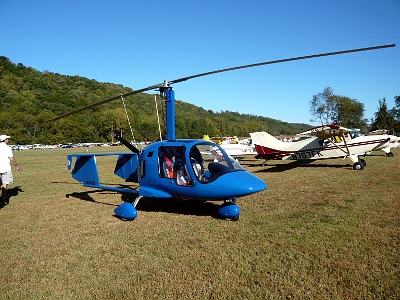
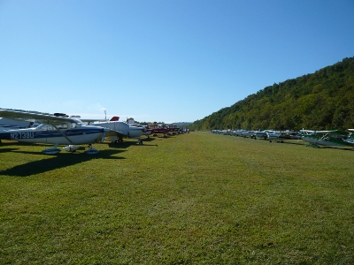
The Lee Bottom Flying Field is a 4100 foot turf airstrip nestled on bottom land in Indiana between a bluff and the Ohio River. This place was a new discovery for me, along with the fact that they have a Wood, Fabric and Tailwheels Fly In every September. Steve Howe, over in Woodstock, got me all pumped up to attend this year’s fly in, scheduled for September 25th, with he in his Funk and me in my Taylorcraft. It looked like an interesting trip, with the added attraction of having the prototype Thatcher CX4 being based out there. This is because we’re both building our own copies. As it turned out, Steve couldn’t go, but I was itching to travel, so I went by myself anyway. The forecasted headwinds didn’t look too bad for Thursday the 23rd, so I got an early start, getting off the ground at 5:15 am.
It was still pitch black, but there was a string of red hazard lighted towers leading me to my first check point, Fryeburg. After a half hour, dawn broke, and it was light by the time I got to Fryeburg. I continued directly over Lebanon, where I woke up the tower operator to let him know I was transiting his airspace. The air was surprisingly rough in the mountains at this early hour. My bladder couldn’t make it to the planned first stop in Glens Falls, and I set down at Rutland to make a quick run into the terminal building.
In fifteen minutes I was off again, over-flying Glens Falls, on course to Hamilton in central New York. I encountered a solid cloud layer just west of Great Sacandaga Lake. I didn’t think it would last, so I stayed up on top. It was a relief when the clouds dissipated when I entered the Mohawk Valley. They thickened up again when I crossed to the other side of the valley, so I dropped down underneath, and bounced along between clouds and the hills. I estimate that I was just one set of hills short of Hamilton, when the clouds lowered below the hill tops. I turned back towards Utica, and looked for the Frankfort-Highland Airport to the southeast of Utica. I couldn’t find it.
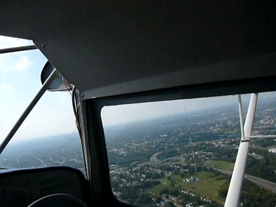
I spent a lot of time trying to find Frankfort-Highland, Nellis sailplane strip and Fulton County airports. Visibility was ok, but I just couldn’t find anything. Griffiss AFB/Rome Int’l was easy enough to see, when I flew back up river to Utica. I had had enough bouncing around, dodging clouds and flocks of Canada geese, and I had to pee really badly. Since I was navigating with a four year old chart, I wasn’t sure of the right tower frequency, seeing how Oneida County was now closed, and Griffiss AFB was now Rome International. While fumbling around with the chart and the radio, I busted their controlled airspace, and since no one else was using the runway, I went ahead and landed. As I pulled up to their new gas pump and shut down, an airport security truck came rushing up. The driver gave a me cell phone dialed up the FAA lady in the tower. While dancing from one foot to the other, I told her I had called the wrong frequency. She said she was going to write me up as a deviation, which was fine since I’m a deviate anyway. The security guy told me the gas pump wasn’t in service yet, so I taxied behind his truck to the FBO’s ramp. The name of the FBO was Million Air. I knew right then that I was in the wrong place. There were just four small planes parked on the ramp, and nobody moved while I was there. I sat around for a couple of hours, until the sky opened up, and when another weathered-in 172 pilot left, I took off, too.
At Million Air I had the fuel truck put six gallons of 100LL in each of the three tanks. Normally this would be plenty, but I hadn’t figured on all the gas I’d wasted, circling around south of Utica. I flew underneath the controlled airspace at Youngstown, Ohio by flying between two 2500 foot towers south of the city at an altitude of less than 2500 feet.
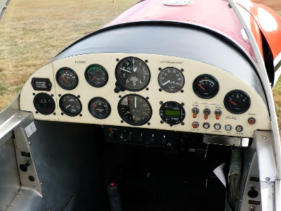
It was hard to pick out the towers in the haze until I was quite close. After threading this needle, it was only another twenty eight miles to Barber Field in Alliance; however, I had been in the air for four hours, and, my float wire stopped bobbing. That meant fifteen minutes of fuel remaining. It also meant that I had better be real sharp at picking the Barber grass airstrip from amongst all the surrounding hay fields. Rather than risk running out of gas and having to push the plane to the gas pump, and since I was pushing against a west head wind, I went straight in on runway 27 at Barber Field. Forrest Barber trundled out in his golf cart, and we put 24.2 gallons of car gas into my 24 gallon fuel system.
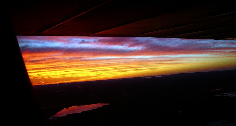
It was now four o’clock and the sun was getting low. Nevertheless, I took an hour’s break for ice tea and crackers. The Midwest was having a record heat wave. The temperature was in the 90’s. Grass was brown and water levels were low. I pushed on. My oil temperature was creeping up, and the pressure was starting to fluctuate. This indicated that oil was getting low and starting to foam, so at my next major check point, the Newark, Ohio airport, I landed and added a quart that I had brought with me. This was a fifteen minute stop. According to the dust stirred up by farm tractors below, the wind was right on my nose. But a thousand feet up it might have been a little different. In any case, without any prominent land marks, I got a little south of course. At dusk at 7:35 pm, I found myself over the Pickaway County Memorial Airport at Circleville, Ohio, and landed. This airport had a chain link fence all around it, but was deserted at this hour. I tried to be inconspicuous, and taxied onto the grass at the far end of the ramp, where I pitched my tent. After getting water in my jug from a spigot on the side of the pilot’s lounge, I toasted a bagel and made tea in my tent. It was hot. I didn’t need any clothes, and I didn’t need any covers that night. Freight trains rumbled by on one side during the evening, and National Guard helicopters made low practice passes down the runway on the other side, but nobody bothered me.
In the morning after I’d finished breakfast in my tent, Max showed up. Max owned the big hanger I was parked next to. He invited me in and offered coffee. It was a relief to find that this wasn’t one of those municipal airports where they chase off squatting travelers in old beat up airplanes. Max had a T-6 and a Navion, a classic old pickup truck and a kit hot rod in his hanger, with a machine shop in a side room. He helped me work the gas pump as I filled up with the “cheapest 100LL around these parts”. I shaved and bathed at the sink in the nice restroom in the lounge; actually feeling human again.
The wind had started to blow at dawn. This promised to be a rough leg, Max suggested that I wait it out, but at 9:35am I went anyway. It was rough, and for the first hour I couldn’t tell if I was on course or not, but son-of-a-gun, I hit the first major check point, Clermont, Ohio right on. This was confirmed by the name on their water tower.
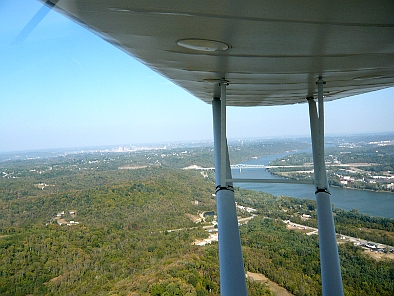
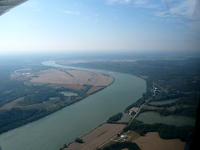
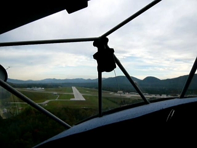
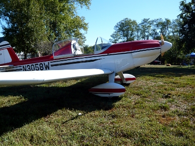
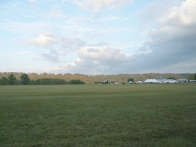
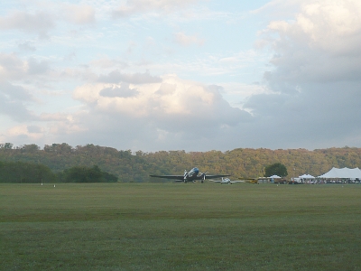
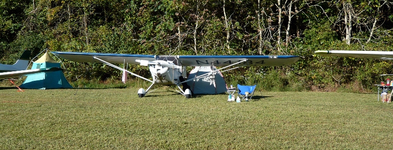
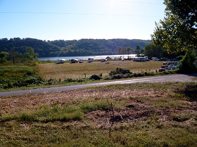
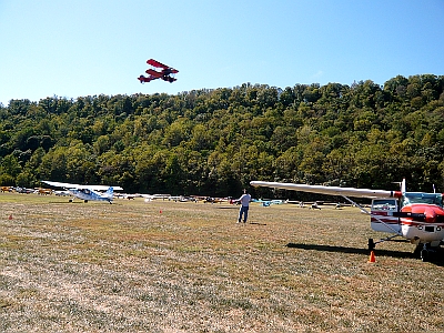
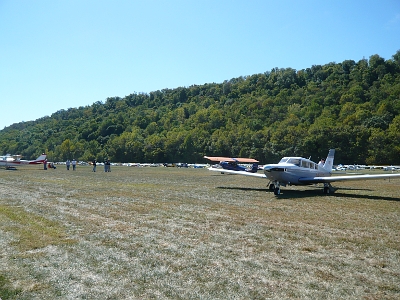
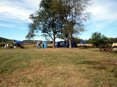
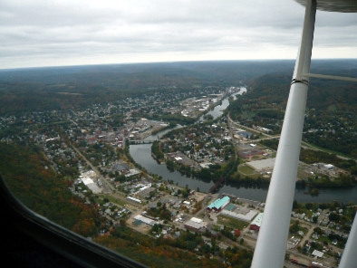
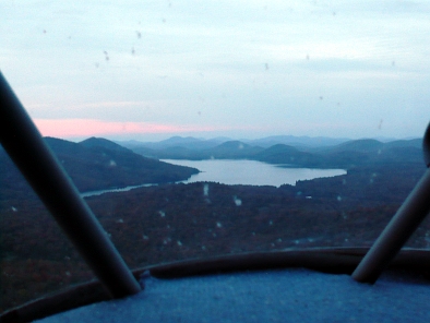
The rest was easy navigation, skirting south of Cincinnati and shadowing the Ohio River. After two and a half hours from Circleville, I was over the Ohio River on down wind for Lee Bottom runway 18. While bouncing along ten feet over the runway, a vortex off a clump of trees slammed me into the ground. The plane stopped short, listing to the left with the ELT going off. The engine was still running, and I could taxi, so followed the flag man to my parking spot next to the bluff. Then I shut off the ELT and checked the damage. I had broken one of the two bungee cords on the left landing gear.
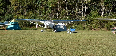
After holding a death grip on the wheel for the past two and half hours, I needed to just sit. I set up camp and sat under the wing, watching the other arrivals. Bill, the fix-it man, showed up with his Jeep Cherokee full of tools. We called Aircraft Spruce and ordered a new bungee for delivery by UPS over night. Then he called his buddies in Louisville to bring bungee tools with them when they flew up. In the afternoon the south wind died down, and it started to cool off. I should have waited back in Circleville.
At four pm, pilot registration opened up on the other side of the field, so I went over and signed in. Ginger Davidson, the airstrip owner, noted that I had come from Maine and that I had won the prize for the longest distance flown. I asked what the prize was, and she told me I got to streak down the runway. Well, it was certainly hot enough, but I didn’t have a towel handy for a cape. Now these were my kind of people.
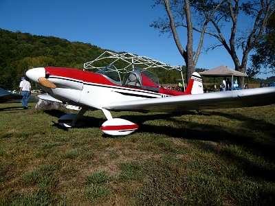
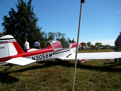
It was good to hit the showers first thing Saturday morning. I got a chance to visit with Peter Beck, licensed purveyor of quick-build Thatcher CX4 parts, and sit in the prototype CX4.
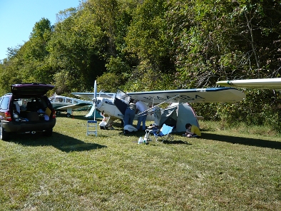
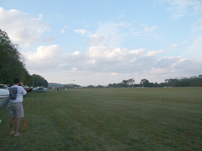
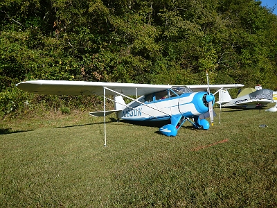
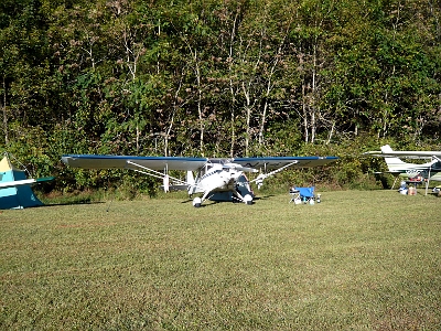
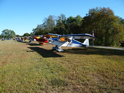
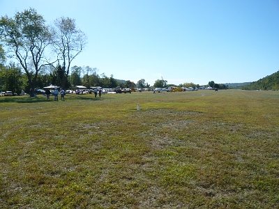
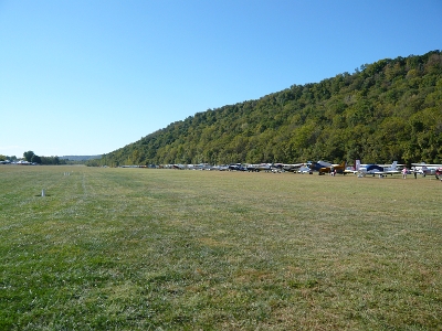
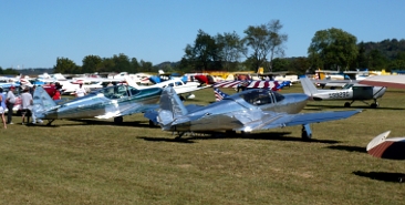
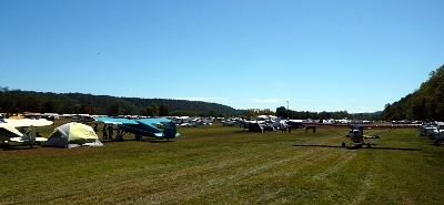
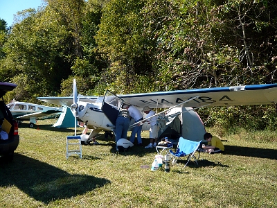
Fly In Gallery
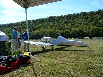
Early in the afternoon, I had just heated up water for tea, when Bill showed up with my new bungee cord. A whole bunch of fly in volunteers converged on my plane, and before I knew it, I couldn’t get near it. I just stood back and let them do their thing. They succeeded with the second bungee tool they tried, then I helped put the seat back together.
There was talk of bad weather moving in, so Sunday morning after availing myself of the provided pastries and juice, I took off at 7:45, circling for a low runway pass before heading east. The air was smooth, and navigation was dead on. I was back in Circleville at 10:00. I met Max again and topped off my tanks. At 10:40 I was airborne again, and cruised just under the 3500 foot overcast, touching down at Barber Field in Alliance at 12:35.
Here I topped off the nose tank with 9 gallons of car gas; hey, that’s only 4 1/2 gallons per hour! After a break for soda and crackers, I was off again at 1:20.
After threading my way between the two 2500 foot towers south of Youngstown, I turned on course for the New York Finger Lakes. My compass navigation was good, and I passed right over the white candle pin of the Tidioute VOR and then Warren. PA, with its closed downtown airstrip.
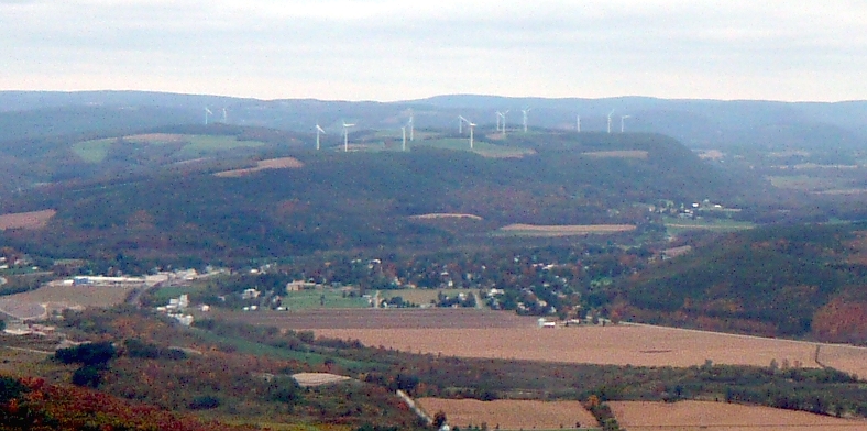
Crossing the Scandia Reservoir and the NY/PA state line, my mp3 player battery was getting low, so I unfastened my seat belt and ducked under the instrument panel to plug a little inverter into my hidden cigar lighter socket. Its good to keep the crew properly sedated with classical music while flying over the most remote part of the trip. An interstate highway appeared right on cue, and that took me past wind turbine covered hills part of the way to the Finger Lakes. Compass navigation remained good, and I passed right over the Georgetown VOR on the way into Hamilton, NY.
It was 5 o’clock sharp, and the FBO operator had just locked up for the night, but he unlocked everything and filled my gas so I wouldn’t be stranded. He went home for supper, but offered the airport car for my use. It was an old Ford Explorer with rusted out rocker panels and a driver’s seat back that wouldn’t stay upright, but it ran well. I drove a mile down the road to McDonald’s for a value meal with a milk shake. I needed a meal of any kind. I was back in the air at 6:00. Daylight was fading fast. I knew I couldn’t camp out at the Glens Falls municipal airport, and I decided not to push my luck by flying over the mountains at night, so I went up to Piseco for a peaceful night in the Adirondacks. It’s located in a valley at the head of a lake. There are public rest rooms there to serve the hiking trail that runs past the airport. I was surprised to find a Cessna 150 parked on the ramp. There was a young couple there; he was a flight instructor and she was a student on her first cross country, but I think there was more going on. They had a bottle of V-8 juice and a bag with two muffins that they hadn’t eaten which they gave me before they departed. I camped right on the ramp. The rest rooms were locked up for the winter, but that didn’t matter as I had some water with me. I could see the whole milky way before the clouds moved in that night, end of day four of the journey.
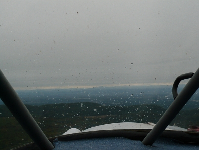
In the morning the weather had caught up to me; clouds were down to the hill tops. I had my breakfast of muffins and V8 juice, then packed up and headed out. I tried going east from the south end of the lake, but that way was socked in solid. I turned back and followed the road north past the airport. When the road forked north and east, I went east. I was now down below the hill tops in light drizzle. When the road forked again north and south, I went straight into the unknown, following a compass course of 120 degrees, more or less. The more or less was due to the need to avoid impacting terrain. I had a mile or two of visibility. Eventually I broke out over the outlet of Great Sacandaga Lake, and just over the next ridge was the tall smoke stack at Glens Falls. There were maintenance vehicles on the main runway at Glens Falls, so I landed on the cross runway. In the terminal building I shaved and washed my face, then had another breakfast at the lunch counter before setting out again at 9:20.
As I approached Rutland, it didn’t look good. The mountain range just to the east of Rutland went up into the clouds. I landed at Rutland and sat for 15 minutes considering my options. I decided to try finding a way through to the south. It was rough and slow going down the valley to the south against the strong head wind. At the next town to the south, I tried following a road east through the mountains. The road climbed until I went IFR and had to turn back. I didn’t want put up with the rough air going back to Rutland, so I flew back to Glens Falls and landed. There I sat and studied the radar off and on. I topped off the gas and bought a quart of oil. It was starting to mist in Glens Falls and the sky looked brighter over Vermont, so I set out again at 2:15. At Rutland I went south down the valley again. Now the wind had lessened. The plan was to follow the railroad tracks through Ludlow over to Springfield, Vermont, reasoning that railroads tend to follow valleys and don’t go up over mountains, and secure in the knowledge that the only tunnel in all of New England was on I-91 in southern Connecticut.
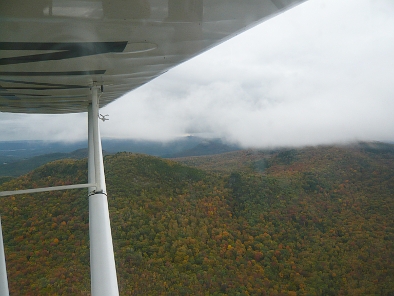
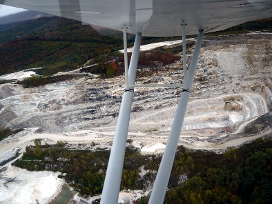
This plan was doomed from the start, since I picked up the wrong set of tracks. At the time I had no idea where I was going, but I know now that I was paralleling route 7, trapped in a valley. At times I had zero forward visibility, but through all the twists and turns I kept the tracks under me. Eventually I came to a “Y” in the tracks at a river. I didn’t expect to encounter a rail junction out in the middle of nowhere, so this necessitated a command decision. I followed the tracks to the left, but after a short while I determined from the boulder wakes in the river that I was headed upstream. I turned around and started down river thinking it must flow into the Connecticut River, but discovered that I was now heading west. As it turns out, this was the Boston to Albany line, and if I persisted, I would have ended up back close to Glens Falls again. I turned around and followed the tracks back up river. Just past the track junction was short grass strip. I filed that away in memory in case I had to quit flying. Just beyond that I flew over the town of Hoosick Falls, NY. I only know this now because I have since retraced my route by zooming in and following the railroad tracks on Google maps. I flew past a small college town (Williamstown), then came to a town with a single paved runway, orientated 29-11. I dug out my airport directory and started flipping through the pages, first Vermont – no match, then New Hampshire – no match, so I tried Massachusetts and BINGO! there it was, North Adams. This was confirmed when I went around the bend and came to Adams with its huge quarry in the side of Mount Greylock.
The runway at North Adams was X’d out, so there was no stopping now. I tried following the road northeast, but the terrain rose, the clouds lowered and I got slammed around by turbulence. At Adams the railroad tracks zig-zagged up into the Berkshires and disappeared in the clouds, so that was out. I continued south down the highway to Pittsfield. Just after I landed there the ceiling dropped down to the trees. It was now 4:35 and I was done for the day.
I hung out in a break room the terminal building, and perused their meager library. There was a hot &cold water dispenser, so I could make tea, cup-of-soup and instant oatmeal. I was hoping to sack out on the couch there, but around 8pm Matt, the line boy who closed up, said I had to go. He offered to take me downtown to a motel, so I went back out to the plane and gathered up my clothes, toiletries and guitar. When Matt saw the guitar we became buddies, as it turned out he was a bass player. I signed in with the nice Indian lady at the Lenox Motel, and Matt was on his way home. I set out at six the next morning, hiking the four miles back to the airport in the pitch dark. I suppose I could have tried hitch hiking, but who’s going to pick up a stranger on a dark street carrying a Thompson submachine gun concealed in a guitar case. After breakfast in the break room and more daylight, I put six gallons of gas in one wing tank and took off again.
I could see a small gap between the cloud base and the top of the first ridge to the east. I was going to follow the high tension line that led straight to Turners Falls where the Connecticut River would give me lower terrain. At the crest of the second ridge I went solid IFR and had to turn back. I tried going south to Great Barrington for an end run around the hills, but immediately got slammed by a gust that turned all my belongings in the plane upside down. About this time I noticed my sweaty palms were pealing the paint off the control wheel. I returned to the break room, and was quite content to spend the rest of the day reading a paperback novel. That night, Matt took me back to the Lenox Motel.
He was coming back into work at six the next morning, so he picked me up on the way. The wind had died down and the clouds were broken. The forecast was for thunderstorms later, so I beat a hasty exit at 7 am. It was an easy flight along the power line now, and at Turners Falls the sky opened up so I was able to go up to 3500 feet. I was hoping to use Mt. Monadnock for reference, but it was hidden in a cloud deck. I stayed up on top where it was smooth flying. When the sky opened up again I found myself approaching Manchester. I skirted west, overflew Concord and continued on home. I set down at Norridgewock at 9:20.
It was now Wednesday the 29th. I had been gone for most of seven days.
